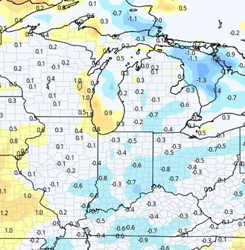


High pressure continues to sit right on the top of the Great Lakes region. This high will park on top of us through midweek next week, giving us a very warm, very dry setup over the entire states of Indiana and Michigan. We expect no precipitation, not even a threat. Evaporation rates will remain high, drying swift. This should be the window of opportunity to get the remainder of planting done, and look at things like haying or forage work all across the region. 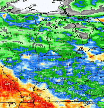
Our next chance at moisture in Michigan comes together with a minor trough boundary sagging southeastward through the UP and northern parts of Lower Michigan next Thursday midday and afternoon. However, southern Lower Michigan all of Indiana staying sunny, warm and dry through all of Thursday. The boundary makes it into northern Indiana for early Friday morning with hit and miss scattered showers for the northern third. Then Friday midday and afternoon we see pop up scattered showers in central and southern Indiana. All in, all done we can see .25”-.75” of moisture in Michigan with close to 60% coverage and a tenth to half an inch in Indiana with a similar 60% coverage. Behind that minor system, we turn out partly sunny for Friday late afternoon and for Saturday the 6th. Then we go mostly sunny, warm and dry Sunday the 7th and Monday the 8th.

The aforementioned high pressure dome is gone by the time we start the week of the 8th. Behind it comes a fairly significant storm complex bringing rain for Tuesday the 9th and into early Wednesday the 10th. We can pencil in anywhere from .25”-.75” through those two days before drying down later Thursday afternoon and evening. We do have the potential for some strong to severe thunderstorm action late Thursday as this system ends in Michigan, but that severe threat could fluctuate greatly in timing and location by the time we get there. In any case behind that final front, we do see low pressure slowly exiting the Great Lakes region to the east and north. This likely creates plenty of cloud cover, and some wrap around moisture that circulates back around over Michigan primarily, but even down into Indiana. With that setup we likely cant rule out a few hundreds to a few tenths lingering through the 12th and maybe into early the 13th. However, a quick look back west shows another weather system getting ready to move out of the Great Plains for the weekend of the 13th and 14th, that likely throws moisture our way for the following week. The map at right shows cumulative precipitation potential the 9th through the 12th.
Extended Period:
Closer to normal precipitation settling in as we move through the extended 11 to 16 day forecast window, particularly as we get toward the end of that the week of the 15th does look to have at least one frontal boundary coming through. 1/4 to 3/4 of an inch of precipitation likely coverage right now. Still up in the air, but temperatures are settling into a normal or slightly above normal range through the extended window.
Weeks 3 & 4:
Week three features above normal precipitation, and week four goes back to near normal. Both weeks 3 and 4 are near to a bit below normal on temps.
Week 3 Precipitation: 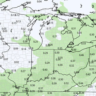
Week 3 Temperature: 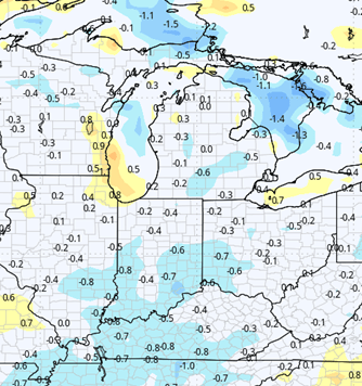
Week 4 Precipitation: 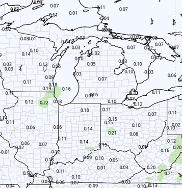
Week 4 Temperature: