

A little bit of everything is in store during this Beacon Credit Union Harvest Weather Forecast. We start by uttering a word we haven’t used all summer in our weather forecasts: tropics!
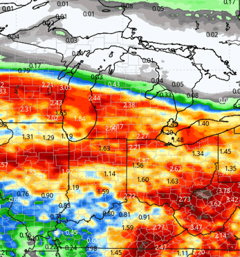
Late last week, Isaias formed in the western Gulf and moved ashore Friday night. While Saturday will be mostly dry, clouds ahead of the storm have been formidable, and the system is moving quickly into the Tennessee Valley. The low-pressure system remaining from the storm will push moisture through almost all of Ohio, along with central and southern Indiana, Saturday night and Sunday. The system’s northern push is not particularly strong. Much of northern Indiana and Michigan will remain mostly precipitation-free, but both areas will experience the clouds we mentioned earlier. The greatest threat in Michigan will be in the southeastern part of the state. The effects of Isaias should last about a day or so.
Next week, all areas will be dry Monday, with a mix of clouds and sunshine. On Tuesday, a strong system will move out of the northern Plains and Upper Midwest and track through the Great Lakes. This will trigger scattered showers in Michigan, and we won’t rule out some hit-or-miss precipitation across the northern third of Indiana. Michigan will see nearly 75% coverage, while Indiana’s coverage will be closer to 30%. Still, clouds across Indiana and southern Lower Michigan will slow drying on Tuesday. All parts of the region will return to dry weather to start Wednesday.
A better-organized front will slide through the region Thursday and Friday, but it will not have an excessive amount of moisture to work with. As a result, we’re expecting scattered showers, with about 60% coverage in Indiana on both days. Michigan will see less than 20% coverage on Thursday, with no precipitation expected Friday. This system may temporarily pause harvest in some areas on those days, but it will by no means be a washout. Colder air behind the system will push southward, so we’ll need to watch for the potential for frost across the region Saturday and Sunday.
The week of the 19th will start dry, but rain showers will return by midweek as we enter the extended forecast period. Temperatures will warm quickly that week, remaining well above normal from the 19th through the 24th.
Extended Period:
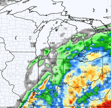
A strong cold front will sweep through the Great Lakes and eastern Corn Belt late Wednesday, the 21st, into Thursday, the 22nd. Showers are likely, with rainfall totals of 0.25 to 0.75 inches and 80% coverage across both Michigan and Indiana. Another weather system is expected to develop for the weekend of the 24th and 25th, bringing similar rainfall totals. Colder air looks likely to move in behind that system as well, but temperatures should remain within the normal range for this time of year.

Weeks 3 and 4:
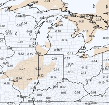
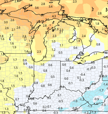
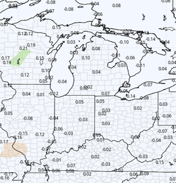
Week 3 is expected to bring normal to slightly below-normal precipitation, while Week 4 looks to be near normal. Temperatures will remain above normal throughout the period, with warmer-than-normal conditions more pronounced in Week 3 than in Week 4.
Week 3 Precipitation:
Week 3 Temperature:
Week 4 Precipitation:
Week 4 Temperature: