

A nice harvest window remains in place for the next two weeks, although conditions will not be quite as perfect as they were this past week in your Beacon Credit Union Harvest Weather Forecast.
We remain completely dry from this weekend through next Wednesday, with temperatures staying above normal. Good drying conditions are expected throughout this period, following heavy morning dew.
Thursday, a system will move through the Great Lakes from the Upper Midwest. This area of low pressure will track across northern Michigan and Ontario, with a front extending back to the southwest. However, we expect precipitation to fizzle as the system approaches, particularly along the front farther south.
That means Indiana will likely see only a few spits and sprinkles, with precipitation coverage below 50%. Michigan will see the best chance for rain, with totals ranging from a few hundredths of an inch to 0.5 inch across approximately 75% of the state. The greatest precipitation amounts are expected across the northern half to northern third of Michigan, including the Upper Peninsula.
Behind the front, temperatures will cool Thursday night and Friday before warming again heading into the weekend of Oct. 31 and Nov. 1. Conditions should remain partly to mostly sunny and dry during that period.

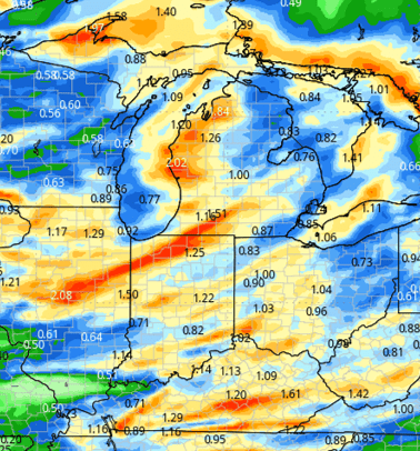
A stronger, better-organized system looks to bring clouds by midday Sunday, Nov. 1, with rain and thunderstorms developing Sunday evening and continuing into Monday, Nov. 2. Rainfall totals could range from 0.25 to 1.5 inches across Indiana, Michigan, and the eastern Corn Belt, with precipitation coverage approaching 100%.
This will be a beneficial rain, although it will temporarily bring harvest to a halt in some areas. The system should move out by Monday night, Nov. 2. The map at below shows the expected precipitation from this system late Nov. 1 and throughout Nov. 2.
Behind the front, temperatures will turn chilly from Tuesday, Nov. 3, through Thursday, Nov. 5, but conditions should begin drying out quickly. Cooler air will slow evaporation initially, especially with clouds expected Tuesday. However, as sunshine returns, farmers should be able to get back into the fields without too much delay.
Extended Period:
Dry air will dominate the latter part of the first full week of November, with temperatures moderating heading into the weekend of Nov. 7-8. The dry pattern is expected to continue into the beginning of the following week.
Weeks 3 & 4:
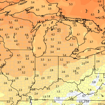
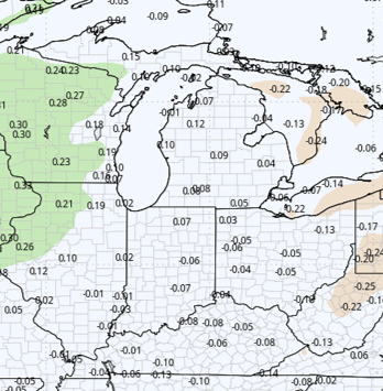
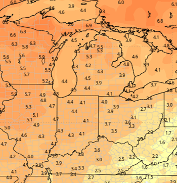
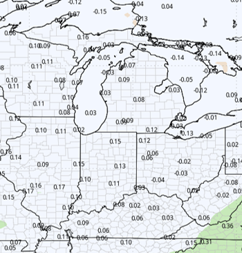
Precipitation is expected to be near normal during Weeks 3 and 4, while temperatures look to remain well above normal through most of November.
Week 3 Precipitation:
Week 3 Temperature:
Week 4 Precipitation:
Week 4 Temperature: